
Indonesia · Southwest Papua
Raja Ampat - Follow the Water
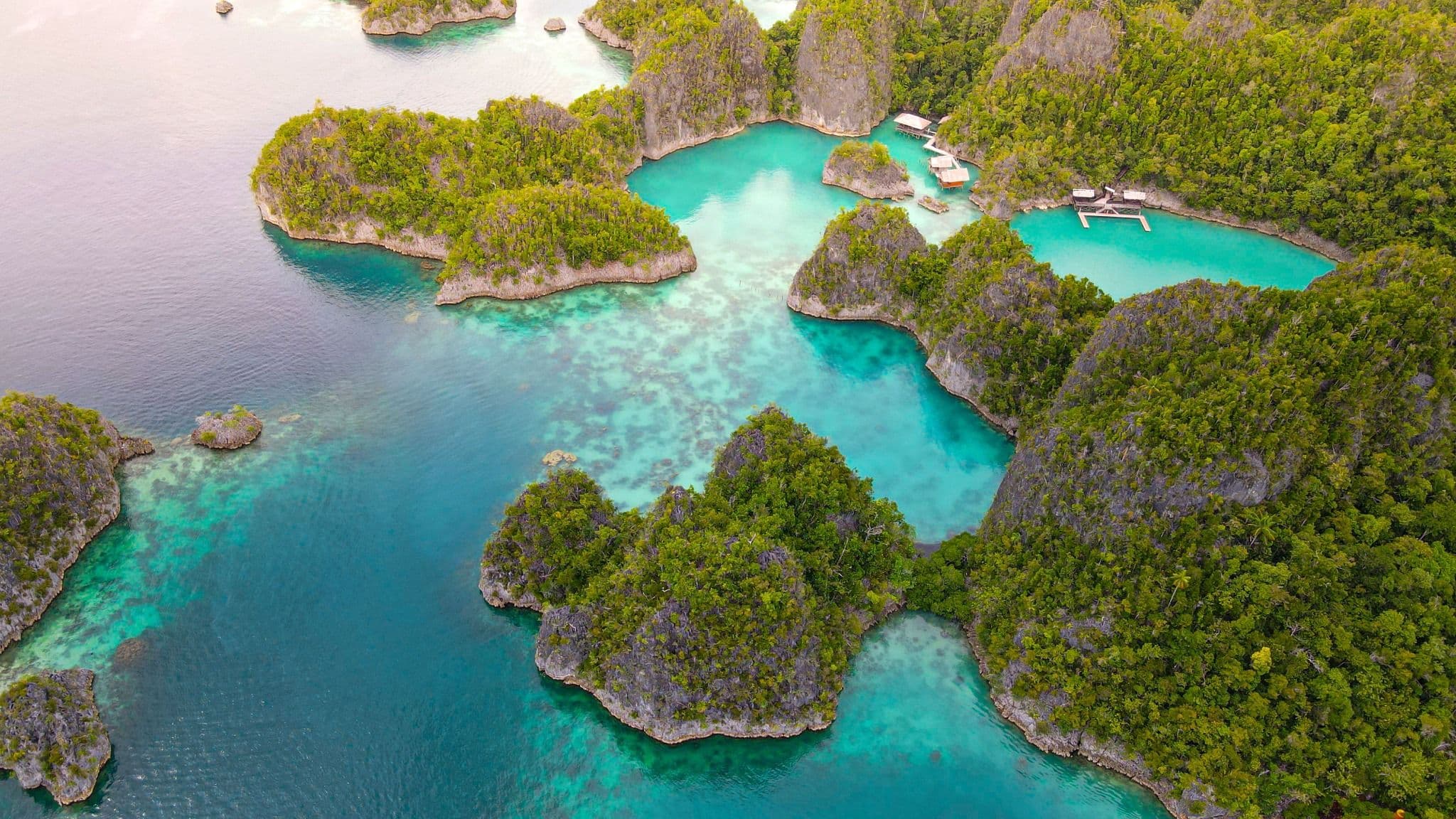
Water is the way through Raja Ampat - between karst islands, villages, marine landscapes and long horizons, with distance itself part of the experience.
In Raja Ampat, water is not the space between destinations. It is the way through them - carrying you between karst islands, villages, reefs and long horizons, at a pace shaped as much by distance and weather as by the places you hope to reach.
The sea is the road
Raja Ampat makes more sense when you stop thinking of the sea as empty space. Here, water is the road. A jetty can feel like a front door, a channel like a street, and an hour spent between islands like a genuine part of the day rather than time lost before the next attraction.
That changes the shape of the journey. The famous viewpoints, limestone islets and underwater scenes may be what first pull a traveler toward Raja Ampat, but the archipelago reveals itself in the movement between them: the change in light over open water, the narrowing of a channel, a village appearing at the edge of an island, or weather altering the plan you thought you had.
This is why LAKSANAVA would begin with a simple proposition: in Raja Ampat, the distance between places is part of the experience.
An archipelago before a checklist
UNESCO describes the Raja Ampat Global Geopark through four primary islands - Waigeo, Batanta, Salawati and Misool - set within an extensive archipelagic landscape. That scale is useful because it immediately challenges the idea that Raja Ampat should be consumed as one compact destination.
The northern karst landscapes around Wayag, the wider Waigeo area, the central islands and the southern world of Misool do not collapse neatly into a single sequence. Choosing where to spend time is not a failure to “see everything.” It is part of designing a journey that respects distance.
A thoughtful route therefore starts by asking what kind of Raja Ampat you want to experience: more time on and in the water, a stronger emphasis on geological landscape, village stays and everyday island rhythm, birdlife and forest, or a balanced combination. The answer should shape the geography, rather than forcing the geography into a standard list.
Read the landscape above the water
Raja Ampat became a UNESCO Global Geopark in 2023. The designation draws attention not only to the beauty of the islands but to the geological story beneath their shapes. Karst, caves, uplifted rock and the relationship between land and sea help explain why the archipelago looks the way it does.
This context matters because the classic Raja Ampat silhouette can otherwise become just another photograph: green limestone rising from blue water. Once the geology enters the story, those forms become evidence of processes measured across far longer timescales than a holiday.
You do not need to turn the journey into a geology lesson. But understanding a little of what you are looking at can make a boat passage, a climb to a viewpoint or a quiet anchorage feel more connected to place.
And below it
The marine environment is equally inseparable from the journey. Indonesian marine-conservation authorities manage protected areas in and around Raja Ampat, with coral reefs, mangroves and seagrass among the habitats identified for conservation. For a traveler, that should change the tone from “what can I collect here?” to “how do I move through this place responsibly?”
Snorkeling or diving may be central to some journeys, while others may experience the marine landscape largely from boats, beaches, mangrove edges and village jetties. Either way, the principle is similar: protected water is not simply a beautiful backdrop. Rules, zones, permits and local guidance are part of the place.
That means LAKSANAVA should never publish a Raja Ampat journey as if access were frictionless. Current conservation requirements need to be checked for the exact places and activities being considered.
Conservation is a relationship, not a slogan
Raja Ampat is often marketed through the language of rarity and abundance. Those claims can easily become louder than the people who live there. A more useful perspective is to recognize that conservation is already connected to community life, government management and local ways of regulating resource use.
In parts of Raja Ampat, sasi is one example of a community tradition that regulates when certain natural resources may be harvested. It should not be reduced to a colorful cultural fact or treated as a ceremony travelers can expect to see. Its relevance to a journey is more fundamental: it reminds visitors that access to nature can be shaped by local responsibility, restraint and collective rules.
The same respect should guide village visits. Ask before making close portraits. Follow community expectations. Use local guidance where it is appropriate. Leave room for encounters to remain ordinary rather than turning every moment into content.
Let the route breathe
Raja Ampat is a place where an overfilled itinerary can work against the destination. Boat transfers take time. Sea conditions change. A distant island may be possible on a map and still make little sense within the rhythm of a particular journey.
Sorong remains an important gateway and current ferry services connect it with Waisai and other points in the region, but exact schedules, vessels and journey times are operational details, not evergreen editorial facts. Once inside the archipelago, the practical route depends on the chosen island cluster, accommodation style, activities and current marine conditions.
This is where “follow the water” becomes a planning method rather than a tagline. Instead of asking how many famous places can fit into the available days, ask how the water connects the experiences that matter most - and where it is worth staying longer.
Weather belongs in the plan
Because water is the route, weather is not a footnote. BMKG publishes dedicated marine forecasts for Raja Ampat waters, including wind, wave and current conditions. That is a reminder that the right plan is partly a conversation with conditions that cannot be fixed months in advance.
For an inspirational article, the safest approach is not to promise a universal “best month.” Different parts of the archipelago and different activities can respond differently to seasonal patterns, and short-term conditions still matter. Near travel, the relevant marine forecast and local operational advice should take priority over an old rule of thumb.
Flexibility is therefore not a compromise. In Raja Ampat it can be part of traveling well.
Follow the water
A good Raja Ampat journey does not need to prove how much ground - or water - it covered. It needs a shape that makes the archipelago feel coherent.
Choose the part of Raja Ampat that fits the traveler. Leave room for boat time to be part of the experience. Read the karst as more than a backdrop. Enter protected marine spaces with attention to the rules that sustain them. Meet communities as hosts and neighbors, not as local color.
Then let distance do some of the work. The stretches of water between islands are not blank spaces waiting to be crossed. They are where Raja Ampat becomes an archipelago rather than a collection of photographs.
Follow the water, and the journey begins to hold together.
A journey concept is inspiration and a planning starting point. It is not a confirmed itinerary, fixed package, guaranteed departure, or confirmed fare — we shape the details together.